
Importe total (1 artículo artículos):
Destino del pedido:

title american history survey (4 resultados)
Ir a los resultados principales
Tipo de artículo
- Todos los tipos de productos
- Libros (3)
- Revistas y publicaciones
- Cómics
- Partituras
- Arte, grabados y pósters
- Fotografías
- Mapas (1)
- Manuscritos y coleccionismo de papel
Condición
Encuadernación
Más atributos
- Primera edición
- Firmado
- Sobrecubierta
- Con imágenes (1)
- No impresión bajo demanda (4)
Gastos de envío gratis
- Gastos de Envío Gratis a EEUU
Ubicación del vendedor
Valoración de los vendedores
-

America's tenth man, a brief survey of the Negro's part in American history. [cover title]
Publicado por Southern Regional Council, Atlanta, Georgia [1944], 1944
Librería: Stony Hill Books, Madison, WI, Estados Unidos de America
Valoración del vendedor:

Libro
Soft cover. Condición: Very Good. Center-stapled 6x9 inches 31 pages, clean and unmarked save for circular library stamp on front cover.
-
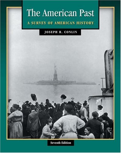
The American Past: A Survey of American History (with InfoTrac and American Journey Online) (Available Titles CengageNOW)
Publicado por Wadsworth Publishing, 2003
ISBN 10: 0534621368ISBN 13: 9780534621360
Librería: SecondSale, Montgomery, IL, Estados Unidos de America
Valoración del vendedor:

Libro
Condición: Good. Item in good condition. Textbooks may not include supplemental items i.e. CDs, access codes etc.
-
The Prose Writers of America. With a survey of the intellectual history, condition, and prospects of the country. [Engraved title, frontispiece and nine further lithograph portraits.]
Publicado por Richard Bentley, 1847., 1847
Libro
Hardcover. Condición: Very Good. First English Edition. 552pp., brown morocco grain cloth, stamped in blind and gilt. Frequent but light foxing, old repair at gutter of front end-papers and spine a bit wrinkled, nevertheless a very good copy. According to Bayless (Rufus Wilmot Griswold, Poe's Literary Executor, 1943, p.126) only 500 copies were produced. Preface dated May 1847, indicating that it was printed from the revised second American edition.
-
Carte particuliere de la Caroline: dresse sur les memoires le plus nouveaux par le Sieur S[anson] Mortier, Pierre, edited anno 1700, contemporary coloured, below margin little waterstained. Size of the sheet: 52 x 63 cm. Despite the title stating that it is by Nicolas Sanson, the map is, in fact, of English origin, derived directly from the 1695 map by John Thornton and Robert Morden. The Thornton & Morden map was based on a survey Maurice Mathews, Surveyor General of Carolina (1677-1684). REFERENCES: Burden, Mapping of North America, 768 History: One of nine maps published by Pierre Mortier in 1700 as Suite de Neptune Francois, ou Atlas Nouveau des Cartes Marines
Publicado por Mortier, Amsterdam, 1700
Librería: Hammelburger Antiquariat, Hammelburg, Alemania
Valoración del vendedor:
Mapa
Kein Einband. Condición: Ausreichend. Carte particuliere de la Caroline: dresse sur les memoires le plus nouveaux par le Sieur S[anson] Mortier, Pierre, edited anno 1700, contemporary coloured, below margin little waterstained. Size of the sheet: 52 x 63 cm. Despite the title stating that it is by Nicolas Sanson, the map is, in fact, of English origin, derived directly from the 1695 map by John Thornton and Robert Morden. The Thornton & Morden map was based on a survey Maurice Mathews, Surveyor General of Carolina (1677-1684). REFERENCES: Burden, Mapping of North America, 768 History: One of nine maps published by Pierre Mortier in 1700 as Suite de Neptune Francois, ou Atlas Nouveau des Cartes Marines.

![Imagen del vendedor de Carte particuliere de la Caroline: dresse sur les memoires le plus nouveaux par le Sieur S[anson] Mortier, Pierre, edited anno 1700, contemporary coloured, below margin little waterstained. Size of the sheet: 52 x 63 cm. Despite the title stating that it is by Nicolas Sanson, the map is, in fact, of English origin, derived directly from the 1695 map by John Thornton and Robert Morden. The Thornton & Morden map was based on a survey Maurice Mathews, Surveyor General of Carolina (1677-1684). REFERENCES: Burden, Mapping of North America, 768 History: One of nine maps published by Pierre Mortier in 1700 as Suite de Neptune Francois, ou Atlas Nouveau des Cartes Marines a la venta por Hammelburger Antiquariat](https://pictures.abebooks.com/inventory/md/md30811958253.jpg)