
Importe total (1 artículo artículos):
Destino del pedido:

blake john ainslie ben sir (1 resultados)
Ir a los resultados principales
Tipo de artículo
- Todos los tipos de productos
- Libros (1)
- Revistas y publicaciones
- Cómics
- Partituras
- Arte, grabados y pósters
- Fotografías
- Mapas
- Manuscritos y coleccionismo de papel
Condición
Encuadernación
- Todas
- Tapa dura (1)
- Tapa blanda
Más atributos
- Primera edición (1)
- Firmado
- Sobrecubierta (1)
- Con imágenes
- No impresión bajo demanda (1)
Gastos de envío gratis
- Gastos de Envío Gratis a EEUU
Ubicación del vendedor
Valoración de los vendedores
-
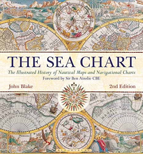
The Sea Chart: The Illustrated History of Nautical Maps and Navigational Charts
Publicado por Conway Maritime Press, London, 2016
ISBN 10: 184486314XISBN 13: 9781844863143
Libro Original o primera edición
Hardcover. Condición: Very Good Plus. Estado de la sobrecubierta: Very Good Plus. First Edition. 2016. 192pp. Sprawling gift inscription to top right corner of front free endpaper. Book and unclipped dust jacket otherwise in excellent condition. "The Sea Chart 2nd Edition with a foreword by Sir Ben Ainslie features forty additional historic sea-chart illustrations with full accompanying text and an additional seventy pages. Ocean sailing needed skill, courage, and experience, and the sea chart was the tool by which ships of trade, transport, or conquest navigated. This examines the history and development of the chart and the nautical map, in both scientific and aesthetic terms as a means of safe and accurate seaborne navigation. The Italian merchant-venturers of the early thirteenth century developed the earliest "portolan" pilot charts of the Mediterranean. The subsequent speed of exploration by European seafarers to the New World, around the Cape of Good Hope, and on trade routes to the East, India, and the Spice Islands were results of the development of the sea chart. By the eighteenth century, the discovery and charting of the coasts and oceans of the globe had become a strategic naval and commercial requirement. Such involvements led to Cook's voyages in the Pacific, the search for the Northwest Passage, and races to the Arctic and Antarctic. The volume is arranged along chronological and geographical lines. Each of the ten chapters is split into distinct halves, examining the history of charting a particular region and the context under which such charting took place, followed with specific navigational charts and other relevant illustrations. Key figures or milestones in the history of charting are then presented in stand-alone story box features." PLEASE NOTE: Heavy book so extra will be needed for shipping to non-UK customers.